


|
This page follows on from our meteorology course page with a further collection of
WWW links of relevance
to meteorology, and references to much larger pages of meteorological
links. The information is divided into short sections: MORE FORECASTS, REAL
TIME DATA, ON-LINE METEOROLOGY, BODIES, CLIMATE CHANGE, PROGRAMS, MORE LINKS
|
More forecastsThe BBC's forecast gives a 5-day summary and a more detailed 24-hour forecast. Wunderground have a good 5-day Aberdeen airport forecast with local conditions and the aviation METAR. This site also links to a comprehensive page giving historic weather data for the day of your choice. If this isn't enough, you could try forecast.co.uk, though they don't say where their forecast comes from but their page has animated UK maps for cloud, temperture, rain, wind and pressure. Accuweather show current weather, incorporating minute by minute forecast (!), a brave month long forecast, though I wouldn't bank on any time beyond a week. A site that features on mobile phones is WeatherBug, who supply current conditions at Aberdeen or a variety of Aberdeen forecasts. The green bar under the logo gives access to a range of other weather-related information. The Press and Journal's 1-day Scottish forecast, supplied by the Met Office, is available on-line through ' Weather' link on the left-hand side of the home page of This is North Scotland. You can obtain direct access to the Met Office Inshore Waters and Shipping. A Regional Map defines the standard forecast areas in Britain, with forecasts from an adjoining table. A further page gives an extended outlook for some sea areas. More detailed sailing weather and tidal reports can be found courtesy Yachting and Boating World. Planning to sail? Look up the Admiralty's tidal predictions. More than simply forecasts is Frank Singleton's weather for sailors page.Metbrief is a useful portal with sections on forecasts and charts, sat pictures, aviation and marine interests. Netweather is an alternative site giving forecasts, charts, lightning and other data, some for free and a wide range on subscription. Gliding and ballooning enthusiasts should look at RASP the Regional Atmospheric Soaring Prediction that gives uplift predictions and more for the next 4 days over the whole of the UK. Current and forecast weather for Aboyne is given by SkyLinkWeather Aviation. Surfing enthusiasts can get short-term and long-term surf forecasts for a range of beaches around the UK including Aberdeen and Stonehaven (look under 'southeast Scotland'!) from magicseaweed. Their home page shows UK images of current wind and swell and has a lot more about surf around the globe. Meteograms from NOAA's Air Research Laboratory, based on global forecasting models can be generated for up to 10 days ahead and beyond. For your location, use EGPD as the WMO identifier for Aberdeen (airport). You select the "Forecast Dataset" you use (try GFS 0- 180h) and can go with the default selection of variables to plot or choose your own from a long list. Don't forget to enter the access code letters you are given at the bottom right of the page. The ARL offer other products on this site too, including custom weather maps. The USAF publish their surface analysis forecast charts with colour coding showing areas of cloud and rain. Their range of charts, along with those from other sources including the meteorological services of Japan, Germany and Canada, is available from Weatheronline 'expert' pages. The US navy Fleet Numerical Meteorology and Oceanographic Centre publish their output for Europe from the NOGAPs 6 hour model (and the GFS 6 hr global forecast model). You can chose to plot from a wide range of variables and loop over the next 180 hours. Ignore 'security certificate' warnings given by some browsers. The University of Wyoming gives access to a range of global cirulation models including the Aviation model (AVN), the medium range forecast (MRF) and the Met Office's Unified Model. You can make up your own charts from a wide choice of what to plot on the coutours and on the colours. For all models you can loop your chosen variables over the times covered by the forecast. Forecasts for the holiday country of your choice are available on the web. Try here for France, or here for an active map of current French weather (select France in the country menu near top right; alternatively Britain, Germany, Italy, Spain, USA); Meteogroup's Weathercast gives an overview of weather in Europe, with separate charts for temperature, wind, cloud, etc., 5-day forecasts and selection for individual countries. Extreme weather events forecasts are offered by the hazard research centre at UCL.
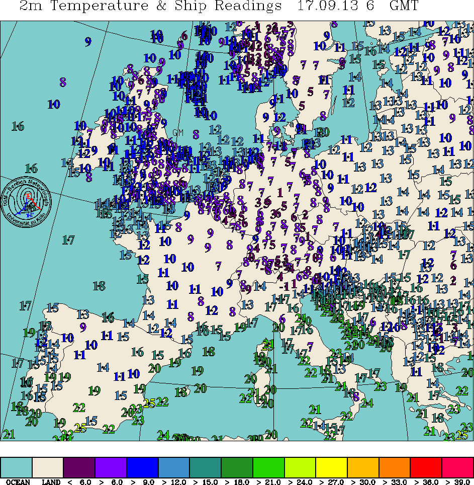
Real Time DataVisit Heriot Watt University Physics Department's Cairngorm Weather Centre to see conditions at the top of Cairngorm. The page includes information about temperature, windspeed at the summit and, normally, pictures of the surroundings and sky from a camera looking up the mountain. Updated every 30 minutes. The Met Office's Weather Observations Website offers recent and current conditions at sites across the UK. A graphical display of conditions by the hour over the past 24 hours at Aberdeen is also available, as is climatological data for Scotland. Graphical Scottish current conditions for VFR (Visual Flight Rules) aviation are given among various aviation forecasts from the commercial site weatherweb. They have a companion site for sailing. A site dedicated to providing data is the UK Weather Information Site which has lots of links and no fancy graphics. Another site mixing current data and forecasts is weatheronline, in this case including some nice legible graphics. The Met Office offer a low resolution rain radar animation over the UK covering the last 24 hours by selecting 'rainfall' in the menu and starting the animation at the foot of the webpage. The weatherweb of the Chilbolton research lab in Hampshire also has on-line weather information including output from the largest steerable met radar dish in the world, and lidar. Current European temperatures and pressures are displayed by the University of Cologne site. Also available is current UK plotted weather. Recent radiosonde data is acessible from the Cologne site too. Click on a star on the map and a table will appear showing the standard times of midnight, 6, 12 and 18 hrs for recent days. Times that have ascent data are shown in bold with an active link to the data. Keeping with the topic of the upper troposphere, the current and forecast jetstream graphics are available from Metcheck. The latest Atlantic analysis, a retrospective 7-day loop (follow the on-screen instructions), and a forecast loop are available from San Francisco State University. An active map of the UK can be displayed courtesy of xcweather.co.uk with overlays of contours of temperature, wind, etc. and a drop-down panel highlighting current conditions at any of the stations shown. An alternative Scottish map is available showing individual values for wind speed, temperature, humidity, heat index, visibility, dew point and more. While on the topic of wind, anyone involved in flying, gliding, ballooning or parachute jumping will find it worthwhile to look at the pages of weatherjack, Jack Harrison a former pilot who maintains a weather site from the Isle of Mull. Maps of various solar radiation expectations are available from the Swedish Radiation Safety Authority (SMHI). Their site is in English. The solar UV index forecast for the UK is also provided by the Met Office. The World Health Organisation describe the idifference between UVA, UVB and UVC. Our nearest UV monitoring station used to be Kinloss airfield but the monitor was moved to Raigmore hospital, Inverness and since then I haven't found it online. AccuWeather data centre give access to a wide range of information, some of which is indexed elsewhere on these pages. The National Data Buoy Center (in the US) offers an active map for selecting data collected by buoys around Britain. Decoded weather buoy observations from around the world are available on a Google map. Ocean surface winds are given by Ascat an instrument on board ESA's MetOp-A satellite for the whole globe with UK fine detail available. ESA's ADM-Aeolus satellite that will send back global wind profiles is due for launch in 2015. A well illustrated brochure describes why this will be an important satellite and explains how it will work. Winsconsin University's terrific global composite pictures include global movies for 2 week's weather. The Met Office offer a page with hourly animated cloud (and other variables) over the UK from the Eumetsat geostationary satellite. Since 2006, ESA has had a program of polar orbiting satellites called MetOp. A and B are operational, C has been built but not yet launched. The Dundee Satellite Receiving Station is excellent for both current and archive images from polar orbiting satellites. Register, free, as a user. The Met Office show a 24-hour animation of geostationary satellite images of the whole UK in IR or visible. For a shorter view of current cloud movement over Europe see Sat24. Once there you can switch to an animation of the visible clouds or rainfall or lightning. The National Air Quality Information Archive comprehensive site provides hourly statistics for a range of pollutants (e.g. ozone, sulphur dioxide, oxides of nitrogen, particulates) from 87 sites around Britain. Also, available directly from the Department of the Environment are current air quality data and weekly graphs from around the country, including Aberdeen. The data is free and may be useful to you if you undertake a pollution study in another course. NASA's spaced-based measurements of ozone and air quality site gives access to a wide range of results. Current and past global ozone levels can be found at the ozone mapping and profiling suite. Further ozone data is available from the World Ozone & Ultraviolet Data Centre (WOUDC) who publish the latest N hemisphere map. For archival data as well, see NASA's Centre for Ozone Data Information. A centralised resources for NOAA satellites is an important reference point for current and archived data from all NOAA's satellites. A superb example of weather data displayed by customised overlay on maps is that produced by the National Weather Service for the US. Nasa's Earth Observatory has been set up to give access to regional and global monitoring data. Well worth a visit. NASA's Earth Observing System (EOS) aims to observe the key physical variables needed to advance understanding of the entire Earth system. This ambitious project was launched on 24 Feb 2000 as one of NASA's flagship projects. NOAA's quikSCAT satellite is no longer operating but ESA's Ascat is produce world maps of the Ocean Surface Winds for today and in archive. A site in Australia offers real-time space weather conditions including the state of the ionosphere, geomagnetic activity and x-ray activity. The Met Office plan to provide space weather forecasts from spring 2014. The Earth Observation Web (EOWEB) from the German remote sensing data centre offers both weather satellite images and a spread of other data such as land and sea temperatures, ozone levels, etc.. The 'web' page uses java. The homepage of the DLR Earth Observation Centre is available in German and English. A European map of current lightning intensity is produced from Kahlsruhe in Germany. On-line MeteorologyNASA is associated with space missions but it has an Earth monitoring role too and a handy introductory web page focusing on this and illustrated with global results includes a section on oceanography, with a range of specific subjects such as topography, temperature, surface winds and a lot more selectable from a left-hand-side menu. NOAA's laboratory for satellite altimetry shows results for sea level changes over the past two decades illustrated by global and regional graphs and a global animation.. Online meteorology guide of the University of Illinois is a teaching resource with text, pictures, diagrams, animations and computer simulations that you may find a useful supplement to the textbook. It also includes a cloud guide. Try the Cloud Appreciation Society for over 1000 pictures of clouds, and more. Plymouth State College offer a 'Weather center' with US weather maps, tutorials and another well illustrated page of cloud types. Archive weather charts since 1998 are kindly provided by Karlsruhe Wetterzentrale. Weatherfaqs has some useful explanatory material, generally at a useful level to extend some of our course content. Among their helpful Miscellaneous Articles see for example the one on Upper Air Meteorology but notice that there are more articles under other headings. The US Environmental Protection Agency provides a useful summary about acid rain. The Environmental News Network has an clear environmental agenda and some good links to related material. The aurora concerns the upper atmosphere but not the weather. An excellent aurora page includes 3-day predictions of auroral activity, and much more. Another site provides an overview of rainbows. The Langley Atmospheric Sciences Data Center is a NASA site specialising in the upper atmosphere data including global tropospheric pollution images and radiant energy maps. Free data but users must register. An extensive set of meteorological applets is available under the WeatherWise banner. The American Meteorological Society has created a 'datastream' page that illustrates a range of concepts using US examples relalting to the current weather. Nicely done. NOAA's National Climatic Data Centre issues hyperlinked weather related news stories every few days. This one is about a selection of the past century's top weather events, i.e the 20th century. NOAA also have a program of monthly summaries of world climate trends. Look at the site of NOAA's Environmental Visualisation Lab to see high resolution satellite images of dust storms, fires, floods, snow, storm systems, tropical cyclones, volcanoes and more. The site is updated daily but maintains indices of past events. For pre July 2010 images see the precursor of this site at Operational Significant Event Imagery (OSEI). Bad meteorology is an idiosyncratic page by Alistair Fraser illustrating common mistakes in teaching the subject and how to think straight about the subject. Most, but not all, of his points are well made. This is an excellent site on the topic of meteorological optics. The site includes two downloadable programs that you can run on your own PC to simulate virtually every aspect of the ice-particle halo complex and also coronae round the Sun and Moon and other diffraction phenomena. The ice particle halo program Halosim3 can be downloaded directly from here. A summary of monthly climate data is available from the Met Office in the form of graphs and tables with links to related information. Climate Research Unit at the University of East Anglia is one of the world leaders in climate documentation and climate change. Look at their on-line climate monitoring data publication 'climon'.The (US) Environmental Protection Agency's climate change website is a very good place to start investigating the causes and controversy over global warming. The global climate annual review is the latest from the National Climatic Data Center. The Carbon Dioxide Information Analysis Center (CDIAC) provides global and hemisphere temperature anomalies from land and marine instrumental records. Data tables and graphs from 1856 to 2010 are available. Atmospheric carbon dioxide concentrations at Mauna Loa have been measured for over 50 years and are often quoted in textbooks. See the latest figures. NASA's global climate change summaries show graphically the changing levels of temperature, ice and sea level from the late 19th century to the present day. The trend has been that ice has been melting and sea-levels rising for the whole of this period but not at a constant rate. One of the new science programs spurred by the need for greater observational data on what is actually happening in the atmosphere is NASA's ATTREX mission aimed at collecting data in the tropical stratosphere using a large remote controlled plane that can stay inthe air for over a day. If you are interested in climate data, explore the IRI/LDEO Climate Data Library. Climate data at stations around the world are available from the source mentioned on the main course page; the AFCCC historic data set is available through NASA and NOAA . The Climate Diagnostics Center is a collaborative programme to identify the nature and causes of climate variation. The site has lots of on-line information. A site with an agenda is Global warming: early warning signs that selectively charts evidence that global warming is with us. The issue is really how much is due to mankind's actions. NOAA's Satellite Remote Sensing Research Group uses satellite data to study seasonal and annual climate variablilty, with special interest in ENSO, the hydrological cycle and other areas. There are strong links to environmental satellites and climate archives. The IPCC publish reports giving the consensus view on climate change. A wider range of documents can be found at the US Global Change Research Information Office. The IPCC have also published a summary report for policymakers on stratospheric ozone and ozone depleting substances based on a more detailed technical summmary. There is a lot going on today to try and establish the natural variability of climate that has been experienced on Earth over a timescale extending back beyond a million years. The Past Global Changes project (PAGES), one of the core activities of the International Geosphere-Biosphere Programme, is all about investigating past climate changes and the stability of climate. NOAA's Paleoclimatology pages are also a good starting point. For two sites that are rather different from the above but draw attention to the continuous use of the world's resources see pages about farm machinery and trucks! BodiesThe Met Office is the source of the UK's primary data about the weather. The Met Office (which is under MOD control) not only provides forecasts for Britain but offers a global service. Find out how they do it; look up the latest British forecasts and check out other links from here. The Royal Meteorological
Society is Britain's premier weather related society, now over 150
years old. It helps promote research and education in meteorology, producing
the monthly magazine Weather for non specialist readers as well
as more advanced journals. The World Meteorological Organisation
is the UN agency that co-ordinates global research, education and data
archiving. Read about their current programmes and long-term plans. They
offer a world map page to access meteorological organisations in countries throughout
the world. The national weather service of the National Oceanic and Atmospheric Administration (NOAA) is of course very strong on US related weather but also has world-wide coverage. The also proved a separate weather page specialising in the latest news, weather warnings, images, etc. The National Centre for Atmospheric Research in Boulder provides a useful entrance to US meteorological research and some current data. The European Environment Agency contains a wide range of reports on subjects from bio-diversity to waste disposal, including ozone monitoring, climate change, air quality other meteorological matters. Look under 'themes' on their site. The https://www.gov.uk/government/organisations/environment-agency Programs US Global Change Research Program
sponsors research into changes in climate, UV levels, land cover and other
factors that affect the long term health of our environment. Their site
is a gateway to related information and data. Nasa's Earth Science Enterprise
gives access to a wide range of programs. It is particularly good on details
of remote sensing missions, current and future. The education resources website of the National Oceanic & Atmospheric Administration (NOAA) introduces the wide range of NOAA's activities. Note in particular the 'Specially for Teachers' section. Yet More LinksLook deeper into our own page of related science.Ant Veal's GreatWeather has a very good set of links worth exploring. |
